The Latest
DASHBOARDS
SEVERE
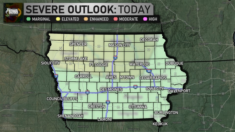
Day 1 Outlook (SPC)
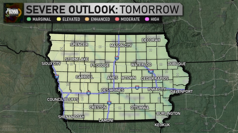
Day 2 Outlook (SPC)
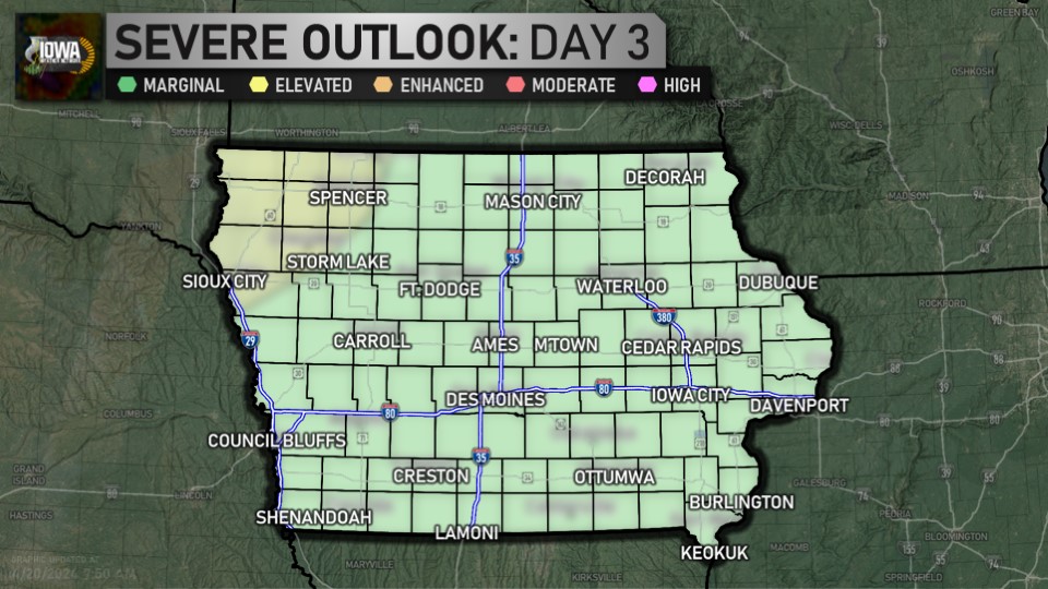
Day 3 Outlook (SPC)

Day 4-8 Outlook (SPC)
WINTER
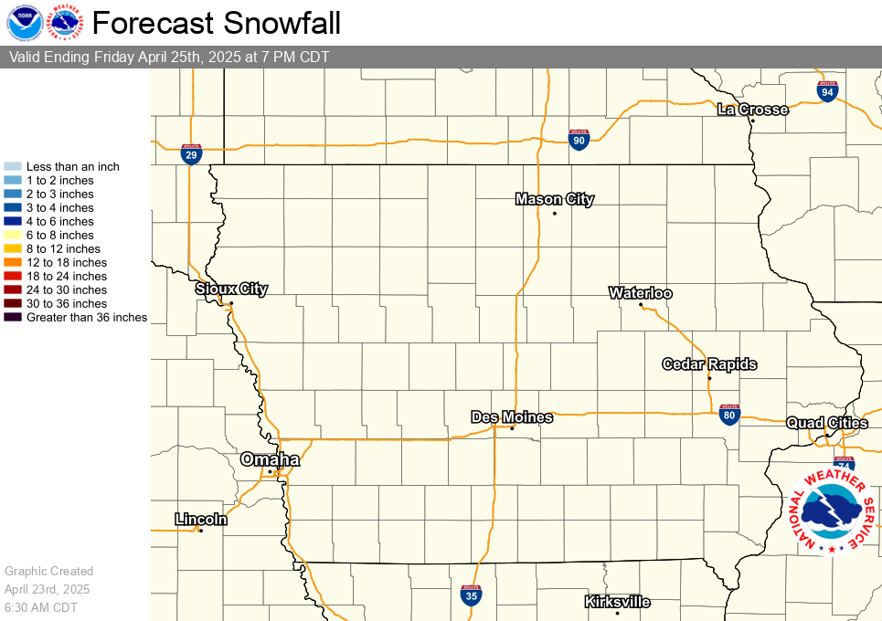
Latest Snowfall Forecast (NWS)
HYDROLOGIC
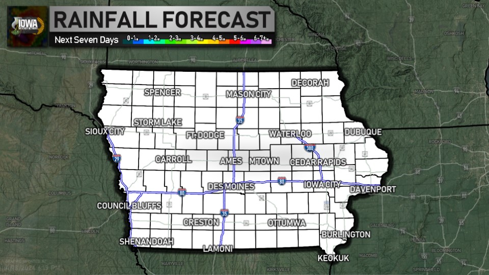
Latest Quantitative Precipitation Forecast (WPC)
DROUGHT
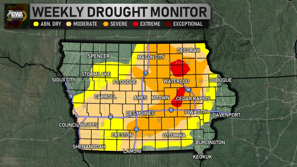
Latest Drought Monitor (CPC/NOAA/UNL)
FIRE WEATHER
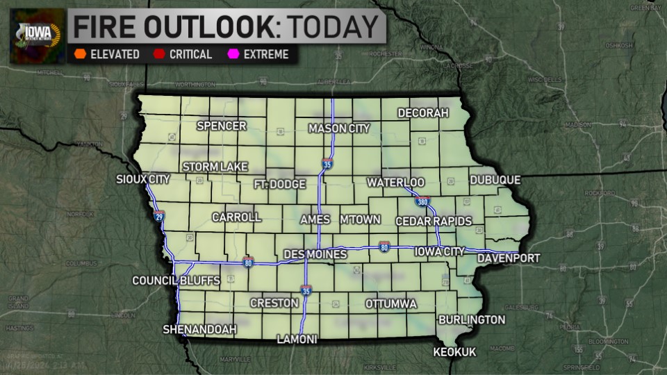
Day One Fire Danger Outlook (SPC)
CLIMATE
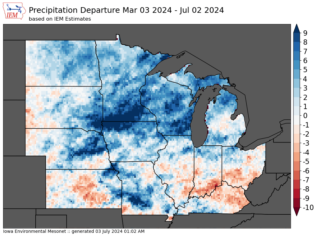
4 Month Precipitation Departures (IEM)
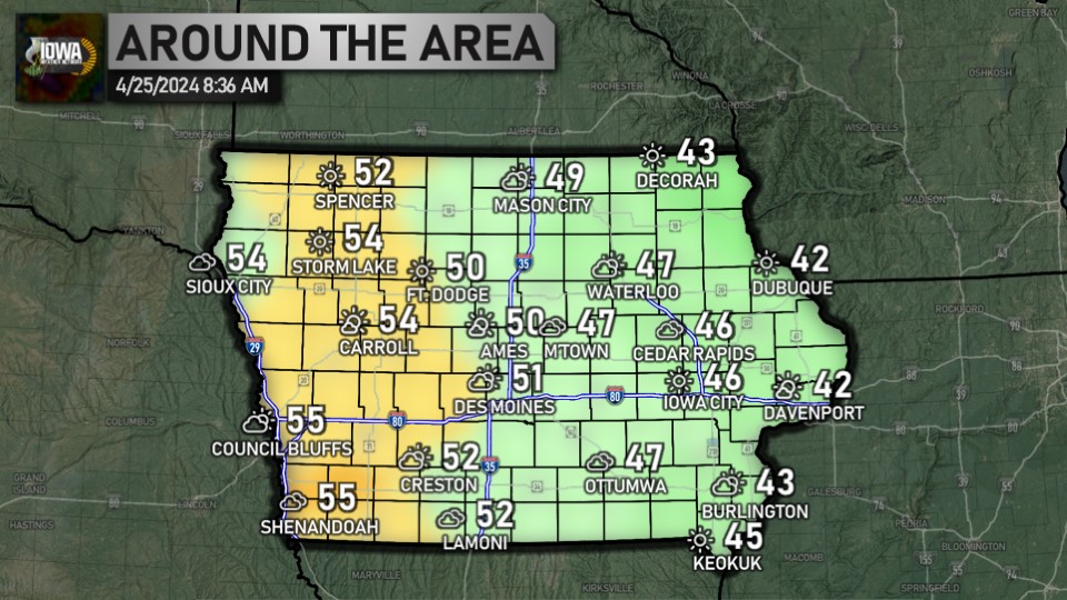
As we sit at the lunch-hour, here's the story out the window... temperatures range from 57 in Sheldon to 82 in Fort Madison and Keokuk. ... See MoreSee Less
0 CommentsComment on Facebook
It's morning over Cedar Rapids... here's a look outside. The airport is reporting sunny and 68. ... See MoreSee Less
0 CommentsComment on Facebook
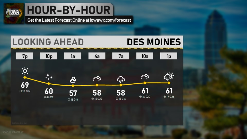
Looking ahead at the morning for Cedar Rapids... get the latest forecast anytime at iowawx.com/forecast ... See MoreSee Less
0 CommentsComment on Facebook
As we enter the second half of the weekend, temperatures this morning range from 50 in Estherville, Forest City, and Spencer to 68 in Keokuk. Enjoy your Sunday! ... See MoreSee Less
0 CommentsComment on Facebook
It's after 5:30, which means it's time for a check of the radar and temperatures. Statewide, we're ranging from 43 in Forest City to 67 in Iowa City. ... See MoreSee Less
0 CommentsComment on Facebook
It's 10:00, which means it's time for the 10 at 10 for Des Moines. Get the forecast for all nine zones online at iowawx.com/forecast ... See MoreSee Less
0 CommentsComment on Facebook
Here's a look at the weather as we head into your Sunday. Full forecast available anytime at iowawx.com/forecast ... See MoreSee Less
0 CommentsComment on Facebook
Saturday high temperatures: we ranged from 79 in Le Mars, Sheldon, and Sioux County to 90 in Perry. ... See MoreSee Less
0 CommentsComment on Facebook
Taking a look at your Saturday almanac for Des Moines, we reached a high of 89 with a low of 65. We had a peak gust of 30 MPH at 3:13 PM. ... See MoreSee Less
0 CommentsComment on Facebook